


US Army Synthetic Training Environment harnesses evolving mapping technology
Geospatial intelligence professionals gathered at the United States Geospatial Intelligence Foundation’s GEOINT 2022 Symposium in Aurora, Colorado, last month to discuss new efforts and achievements in the rapidly growing field. Topics highlighted at the event included how technological advances have influenced the creation and use of maps, including within military and intelligence communities. Maureena Thompson, Army Futures Command, reports.
Follow Army Recognition on Google News at this link
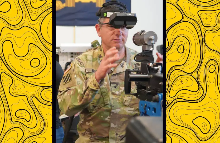
Brig. Gen. William Glaser, Director of the Army Futures Command Synthetic Training Environment Cross-Functional Team, tests out virtual reality equipment during a recent Soldier touchpoint in Orlando, Florida. (Picture source: U.S. Army)
During an April 26 “What is a Map?” panel, guest speakers from the U.S. government and private industry explored how maps have evolved in recent years, what new types of information maps can communicate and why maps continue to be indispensable tools in everything from personal navigation to foreign policy development to warfighting.
“Maps and terrain and that data set is foundational to everything we do,” said Brig. Gen. William Glaser, director of the Army Futures Command Synthetic Training Environment, or STE, Cross-Functional Team.
Glaser and fellow panelists detailed how today’s dynamic, high-performance maps — which frequently utilize 3D imagery and are often informed by an amalgamation of artificial intelligence, fluid data inputs and precision sensors — can improve visibility and thereby increase a user’s understanding of a situation, along with options for action.
“Our relationship with a map now is not just passive,” said panelist Ed Parsons, geospatial technologist at Google. “We’re interacting with the map. The map is changing its contents depending upon what we’re doing, but we’re also sharing what we’re doing with the developers of that map.”
As a result, many of today’s maps are “elastic,” meaning that they can morph and adapt as conditions and user input fluctuate, Parsons explained. It is this near real-time visibility that can provide Army map users with distinct tactical advantages. “The ability to visualize the terrain in 3D is absolutely critical for commanders and Soldiers to understand the operational environment,” Glaser said.
He noted that one of the Army’s core STE efforts, One World Terrain, provides a singular synthetic format for use in multiple scenarios. Viewable in “everything from goggles to laptops to PCs,” the 3D terrain data set is helping to more closely link operational and training activities, thereby enhancing overall readiness.
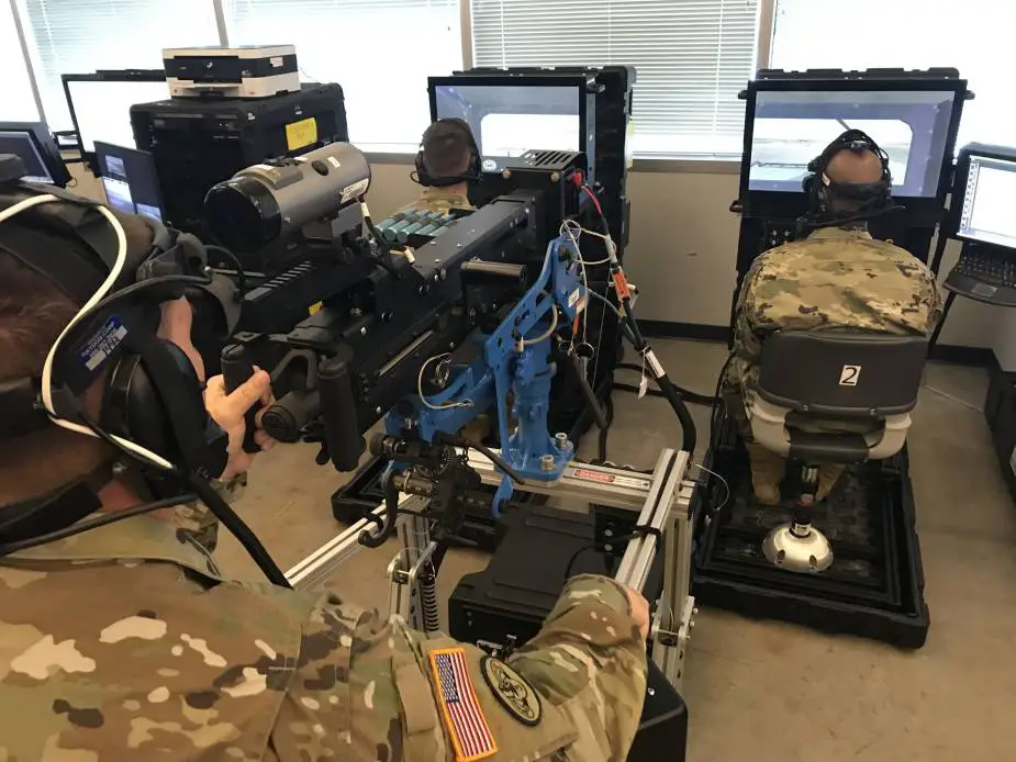
U.S. Army Soldiers use a Reconfigurable Virtual Collective Trainer system to conduct training within a Synthetic Training Environment (Picture source: U.S. Army)
The Army is also developing the STE Information System, a virtual training suite, and equipment such as the Squad Immersive Virtual Trainer, a mixed-reality tool that utilizes a heads-up display.
The ongoing development of a synthetic training platform enabled by advanced mapping technology is groundbreaking because it means the Army “can fight a thousand bloodless battles before we ever put a Soldier into harm’s way,” Glaser said.
The multi-faceted nature of digital maps extends across sectors, of course, and often translates to many users having access to — but also influence on — collective maps. “Maps are probably more widely used now than at any point in our history,” Parsons said. This expanded use of maps has also increased the demand for functionality and format. “Cartography is an art, not just a science,” said Dr. Lee Schwartz, director of the Office of the Geographer and Global Issues at the State Department’s Bureau of Intelligence and Research. “Maps need to be visually compelling as well as providing a lot of information.”
Ensuring map development is participatory, such as by involving the contributions of individuals who live in areas being mapped, is also an important consideration in modern map development. “You have to include the human element always,” Schwartz said.
Moreover, the way maps are used to make decisions means the information they contain needs to be secure and valid. While this is an area for further growth, in many cases, accuracy is attained simply through critical mass. “The maps are now sort of self-healing; by using the maps, you’re contributing to the content,” Parsons said.
Dr. Daniela Moody, vice president of artificial intelligence at Arturo, also highlighted the storytelling nature of maps, which are increasingly moving beyond instructing the user how to get somewhere to informing the user why to go somewhere. “This is no longer a static environment,” Moody said. “Maps are becoming the way to tell a story, the way to make that quick decision.”
Glaser emphasized that while digital maps are ushering in transformational capabilities, traditional paper maps are still necessary, particularly for maneuvering in degraded environments. As such, the Army will continue to promote analog map reading skills and compass navigation fluency even as it implements more interactive mapping systems. “Every Army officer who’s worth his weight in salt loves maps,” Glaser said.
