


Turkey's first unmanned helicopter, ALPiN, is showcased by Titra at IDEF 2021. ALPiN used to be a 2- person capacity helicopter with a maximum flight time of 3.5 hours was transformed into a full full autonomous unmanned helicopter.
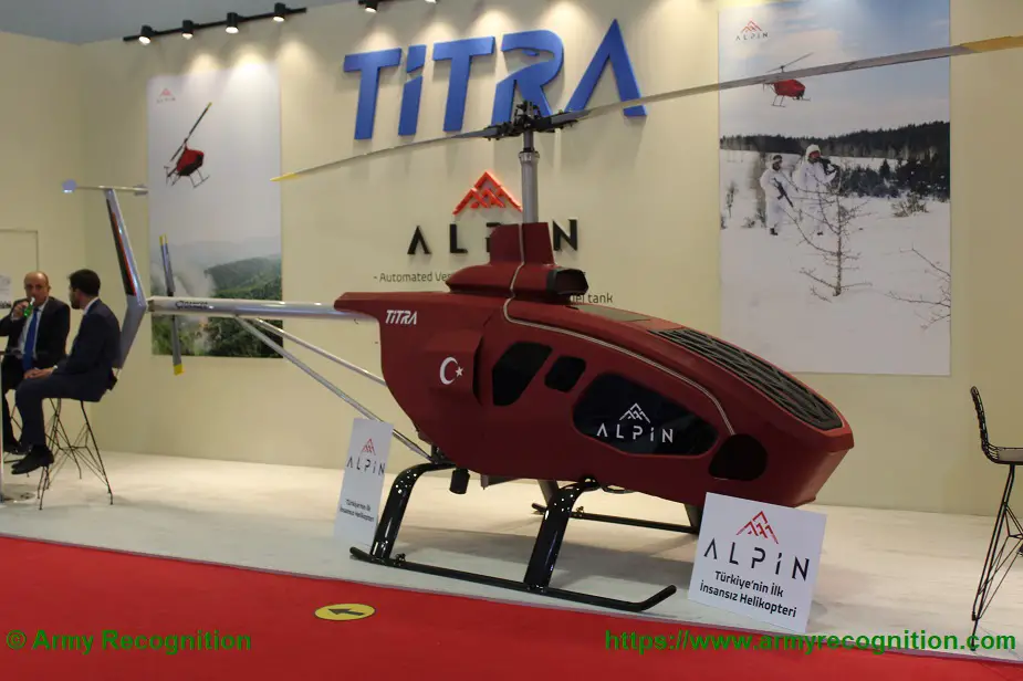
ALPiN maintains its great advantage over manned systems with its ability to access high-risk conflict environments without the risk of loss of life. (Picture source: Army Recognition)
ALPIN Unmanned Helicopter is a rotary wing unmanned aerial vehicle that is autonomisated by changing the control mechanisms and interfaces of a double manned helicopter, controlling the system-specific servo actuators with the developed autopilot system and made autonomous with the developed software.
With one touch, vertical landing / takeoff capable ALPİN, capable of performing assigned tasks fully autonomous and can carry 160 kg payload is the first unmanned helicopter in Turkey. With this load capacity, ALPIN will be able to serve in many military / civilian areas.
ALPIN Unmanned Helicopter System Features:
- Ease of use with its user-friendly interface
- Possibility to assign flight properties such as instant route, speed, altitude.
- Beyond Line out of Sight (BLOS) with optional devices
- Aerial laser marking
- Day and night imaging with infrared camera
- Transmission of EO / IR camera images in encrypted form to the ground station
- Encrypted data communication infrastructure
- Redundant avionic architecture and autopilot system
- Easy integration of additional systems with modular avionic architecture
- Safe / emergency landing with autorotation in case of motor loss (Autorotation)
- Safe / emergency landing for certain emergency scenarios with parachute rescue system
- Region and status restricted (link loss, etc.) autonomous return-to-home capability
- Precise positioning ability
- GNSS tamper/jammer prevention
- Safe flight with the integration of anti-collision systems
- Navigating through the calculation of position, velocity, orientation (Dead Reckoning) using inertial navigation (INS) for GNSS loss and special purpose flights
- Possibility to be transported by light load carrying vehicles with its compact dimensions
- Alternative to control and display with more than one ground control station
- Besides these features, ALPIN can detect, diagnose, recognize and track autonomous targets from a long distance to ensure security in the military field.
It maintains its great advantage over manned systems with its ability to access high-risk conflict environments without the risk of loss of life.
With the feature of hovering on targets for up to 20 minutes, it can also prevent fixed wing unmanned systems.
It can be used for a wide variety of applications such as spraying and soil analysis in agricultural tasks, weather forecast in meteorology, scientific measurements in risky areas.
It can also easily carry out logistic support in mountainous areas and areas where access is difficult.
Autonomous target detection and identification algorithms with onboard AI based image processing software is in development.