


According to a press release published on August 24, 2020, the Company Jacobs is part of the team that was selected by the U.K.’s Ministry of Defence to devise a new system to help the British Army cross water in hostile territory. The ‘Map the Gap’ competition asked the private sector how crossings could be scouted and planned without the need for dangerous reconnaissance missions.
Follow Army Recognition on Google News at this link
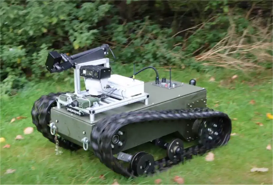
Digital Concepts Engineering X2 UGV Unmanned Ground Vehicle. (Picture source Digital Concepts Engineering)
A key part of the solution is Jacobs’ 6th Sense data analytics system, which was developed to create high-fidelity 3D maps of legacy radioactive facilities before they are decommissioned.
The concept envisages a semi-autonomous remote system that can collect the required measurements without the need to deploy personnel to the potential crossing location. Ground surveys will be carried out using a submersible remotely operated vehicle (ROV) carrying data sensors, soil sampling tools and sonar equipment. Our 6th Sense system processes data in real time, helping military engineers to understand how the riverbed, mudflats and banks will take the weight of a temporary bridge and armored vehicles.
“We are looking forward to developing a new capability which will enable units like the Royal Engineers to carry out vital reconnaissance tasks without putting personnel at risk,” says Jacobs Critical Mission Solutions International Senior Vice President Clive White. “We often borrow technology and techniques from other sectors to apply in the nuclear industry, so it is good to see this technology transfer process happening going in the opposite direction.”
“This is another example of the mutually beneficial relationships we are building with innovative small and medium-sized enterprises.”
The MOD’s Defence and Security Accelerator (DASA), which ran the competition on behalf of the Defence Science and Technology Laboratory, will now fund further research and development of the semi-autonomous reconnaissance and survey system.
Robert Hammond-Smith, DASA Delivery Manager for Map the Gap, explained: “Our vision is to ultimately remove personnel from these dangerous tasks with a remote system that allows more crossing locations to be surveyed, increasing the choices available to commanders.”
The winning competition entry was led by Digital Concepts Engineering, which developed the rugged X2 ROV; drone providers Frazer-Nash Consultancy; and Eijkelkamp Geopoint SoilSolutions, specialists in ground sampling technology.
Jacobs and Digital Concepts Engineering first paired the 6th Sense data analytics system with an X2 ROV last year when they won a competition, funded by Innovate U.K. and the Nuclear Decommissioning Authority, to find new ways to decommission highly radioactive former reprocessing facilities at the Sellafield nuclear site.